Property Record
5740 Brainerd Rd, Chattanooga, TN 37411
NEARBY LISTINGS FOR SALE OR LEASE
Property Detail
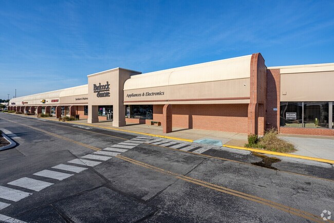
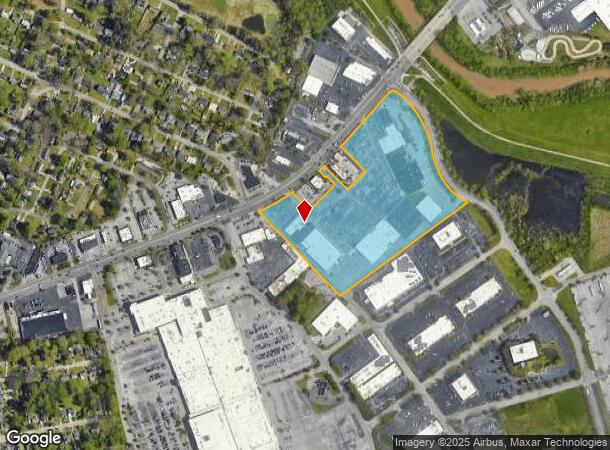
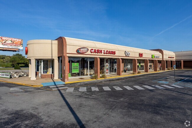
5740 Brainerd Rd
157M-A-017
Brainerd Village Center
Communitycenter
SW 1/4 OF SEC 21 NW 1/4 OF SEC 28 TWP 6 R-3W BRAINERD VILLAGE
X
Hamilton
47065C0364G
Tennessee
2024
19.38 AC
2024
Outlying Chattanooga
003000
Chattanooga
210,176 SF
Chattanooga, TN-GA
DEMOGRAPHICS near 5740 Brainerd Rd
1 Mile
3 Mile
5 Mile
2024 Total Population
3,991
54,689
150,333
2029 Population
4,236
57,904
159,700
Pop Growth 2024-2029
+ 6.14%
+ 5.88%
+ 6.23%
Average Age
39
40
40
2024 Total Households
1,711
23,658
61,880
HH Growth 2024-2029
+ 6.14%
+ 6.00%
+ 6.33%
Median Household Inc
$42,394
$51,689
$50,552
Avg Household Size
2.20
2.20
2.30
2024 Avg HH Vehicles
2.00
2.00
2.00
Median Home Value
$151,440
$178,948
$187,897
Median Year Built
1958
1966
1972
Nearby Places
Map Layers
Map Styles
 Street
 Aerial
- Restaurants
- Banks
- Shops
- Fitness
- Groceries
PUBLIC TRANSPORTATION
AIRPORT
Lovell Field
DRIVE
WALK
Distance
Lovell Field
7 min
2.1 mi
Freight Ports
Georgia Ports - Savannah
DRIVE
WALK
Distance
Georgia Ports - Savannah
403 min
359.0 mi
SALE & LEASE HISTORY
LISTING DATE
SALE/LEASE

Sep 25, 2016
For Lease
Sep 25, 2016
For Lease
Nearby Properties
Address
Land Use
TOTAL SIZE
Lot Size
Zoning
Address
Land Use
TOTAL SIZE
Lot Size
Zoning
832.10 AC
M1
Address
Land Use
TOTAL SIZE
Lot Size
Zoning
292,309 SF
45.28 AC
M1
Address
Land Use
TOTAL SIZE
Lot Size
Zoning
2,336 SF
21.34 AC
R3
Address
Land Use
TOTAL SIZE
Lot Size
Zoning
355,219 SF
27.72 AC
R3
Address
Land Use
TOTAL SIZE
Lot Size
Zoning
5,008 SF
17.97 AC
R1
Address
Land Use
TOTAL SIZE
Lot Size
Zoning
790,207 SF
53.84 AC
C2
Address
Land Use
TOTAL SIZE
Lot Size
Zoning
1,200 SF
14.10 AC
Address
Land Use
TOTAL SIZE
Lot Size
Zoning
209,168 SF
23.28 AC
C2
Address
Land Use
TOTAL SIZE
Lot Size
Zoning
85,068 SF
9.57 AC
Address
Land Use
TOTAL SIZE
Lot Size
Zoning
67,735 SF
17.32 AC
M1
Address
Land Use
TOTAL SIZE
Lot Size
Zoning
66 AC
R4
Address
Land Use
TOTAL SIZE
Lot Size
Zoning
4,800 SF
9.60 AC
R3
Address
Land Use
TOTAL SIZE
Lot Size
Zoning
66,027 SF
2.84 AC
C2
Address
Land Use
TOTAL SIZE
Lot Size
Zoning
88,285 SF
7 AC
R3
Address
Land Use
TOTAL SIZE
Lot Size
Zoning
2,048 SF
7.67 AC
Address
Land Use
TOTAL SIZE
Lot Size
Zoning
215,385 SF
14.10 AC
UR
Address
Land Use
TOTAL SIZE
Lot Size
Zoning
78,423 SF
11.93 AC
C2
Address
Land Use
TOTAL SIZE
Lot Size
Zoning
58,551 SF
5.30 AC
R4
Address
Land Use
TOTAL SIZE
Lot Size
Zoning
151,314 SF
6.60 AC
Address
Land Use
TOTAL SIZE
Lot Size
Zoning
55,289 SF
9.33 AC
C2
Address
Land Use
TOTAL SIZE
Lot Size
Zoning
57,498 SF
5.31 AC
R1
Address
Land Use
TOTAL SIZE
Lot Size
Zoning
41,872 SF
6.29 AC
Address
Land Use
TOTAL SIZE
Lot Size
Zoning
18,254 SF
7.40 AC
R3
Address
Land Use
TOTAL SIZE
Lot Size
Zoning
41,872 SF
7.09 AC
C2
Address
Land Use
TOTAL SIZE
Lot Size
Zoning
68,060 SF
6.17 AC
R2
Address
Land Use
TOTAL SIZE
Lot Size
Zoning
71,458 SF
19.22 AC
M2
Address
Land Use
TOTAL SIZE
Lot Size
Zoning
81,827 SF
8.84 AC
Address
Land Use
TOTAL SIZE
Lot Size
Zoning
2,651 SF
9.50 AC
Address
Land Use
TOTAL SIZE
Lot Size
Zoning
35,740 SF
5.20 AC
R2
Address
Land Use
TOTAL SIZE
Lot Size
Zoning
759 SF
5 AC
The World's #1 Commercial Real Estate Marketplace
Connect with us
© 2026 CoStar Group
The information above has been obtained from sources believed reliable. While we do not doubt its accuracy we have not verified it and make no guarantee, warranty or representation about it. It is your responsibility to independently confirm its accuracy and completeness. Any projections, opinions, assumptions, or estimates used are for example only and do not represent the current or future performance of the property. The value of this transaction to you depends on tax and other factors which should be evaluated by your tax, financial, and legal advisors. You and your advisors should conduct a careful, independent investigation of the property to determine to your satisfaction the suitability of the property for your needs.